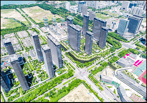
URBAN PLANNING AND DEVELOPMENT
Urbanization is on the rise, with more than half of the world’s population living in cities today. As cities continue to grow and evolve, the need for effective urban planning and development becomes increasingly critical. Enter HC Robotics with their LiDAR (Light Detection and Ranging) mobile mapping technology, a powerful tool that is revolutionizing the way cities are planned, designed, and managed. In this article, we explore the utility of LiDAR mobile mapping technology for urban planning and development, highlighting its transformative impact on creating more sustainable, livable, and resilient cities.
LiDAR mobile mapping technology involves the use of HC Robotics’ LiDAR sensors mounted on vehicles to capture highly accurate three-dimensional data of urban environments. These sensors emit laser pulses and measure the time it takes for the light to return, creating detailed point cloud models that represent the physical characteristics of buildings, streets, and infrastructure with unparalleled precision.

Applications in Urban Planning and Development:
- Precise 3D Mapping: LiDAR mobile mapping technology provides urban planners and developers with precise 3D models of urban landscapes, allowing them to visualize and analyze existing conditions with exceptional detail. These models facilitate site analysis, spatial planning, and infrastructure design, enabling informed decision-making and optimized land use.
- Transportation Planning: LiDAR data enables comprehensive mapping of transportation networks, including roads, railways, and pedestrian pathways. By analyzing traffic patterns, congestion hotspots, and accessibility, urban planners can optimize transportation infrastructure, improve traffic flow, and enhance connectivity within cities.
- Infrastructure Asset Management: LiDAR mobile mapping technology supports the inventory and assessment of urban infrastructure assets, such as buildings, bridges, and utilities. By accurately measuring asset dimensions, condition, and spatial relationships, city authorities can prioritize maintenance activities, allocate resources efficiently, and ensure the long-term sustainability of critical infrastructure.
- Flood Risk Assessment: With the ability to capture detailed elevation data, LiDAR technology aids in flood risk assessment and mitigation planning in urban areas. By modeling terrain characteristics, floodplain extents, and drainage networks, urban planners can identify flood-prone areas, implement protective measures, and minimize the impact of flooding on communities and infrastructure.
- Green Space Planning: LiDAR data facilitates the mapping and analysis of urban green spaces, including parks, forests, and recreational areas. By quantifying vegetation coverage, canopy density, and ecological connectivity, urban planners can prioritize green space preservation, enhance biodiversity, and promote residents’ health and well-being.
Benefits of HC Robotics LiDAR Mobile Mapping Technology:
- Accuracy and Precision: LiDAR mobile mapping technology provides highly accurate and precise data, enabling detailed analysis and informed decision-making in urban planning and development projects.
- Efficiency and Cost-Effectiveness: Compared to traditional surveying methods, LiDAR mobile mapping technology offers significant time and cost savings, allowing urban planners and developers to streamline workflows and achieve project objectives more efficiently.
- Scalability and Adaptability: LiDAR mobile mapping technology is scalable and adaptable to various urban environments and project scales, from small neighborhoods to large metropolitan areas. Its flexibility makes it a versatile tool for diverse urban planning applications.
- Safety and Non-Invasiveness: LiDAR mobile mapping technology is non-invasive and can be conducted from a safe distance, minimizing disruption to urban activities and reducing the risk to personnel involved in data collection.
While LiDAR mobile mapping technology offers numerous benefits for urban planning and development, challenges such as data processing complexity, data privacy concerns, and regulatory compliance must be addressed. Additionally, ensuring equitable access to LiDAR data and technology is essential to promote inclusive and sustainable urban development.
As LiDAR technology continues to evolve, future advancements in sensor technology, data processing algorithms, and integration with other geospatial technologies hold great promise for enhancing its utility in urban planning and development. Collaboration between government agencies, research institutions, and private sector stakeholders will be crucial in realizing the full potential of LiDAR mobile mapping technology to create more resilient, livable, and sustainable cities.
In conclusion, LiDAR mobile mapping technology is a game-changer for urban planning and development, offering unprecedented capabilities for capturing, analyzing, and visualizing urban environments in three dimensions. By harnessing the power of LiDAR technology, cities can make informed decisions, optimize resource allocation, and create more inclusive, resilient, and sustainable urban spaces for current and future generations. Embracing innovation and collaboration will be key to unlocking the full potential of LiDAR mobile mapping technology in shaping the cities of tomorrow.
