MOBILE LiDAR
The HC Robotics Mobile Mapping Solution is designed to revolutionize asset management, road survey, and corridor mapping tasks. It eliminates the need for physical surveys, thereby saving valuable time and money for industries like telecom, utilities, smart cities, railways, oil and gas, and DOT sectors.
HC Robotics Mobile LiDAR improves workflow, by reducing the amount of manpower required for surveying large geographical areas.
Highlights:
- 72MP high-resolution images with up to 5.2M PPS
- Customized mobile mapping solutions
- Unparalleled precision to achieve survey accuracy of up to 1 inch
- Road survey, corridor mapping, asset monitoring

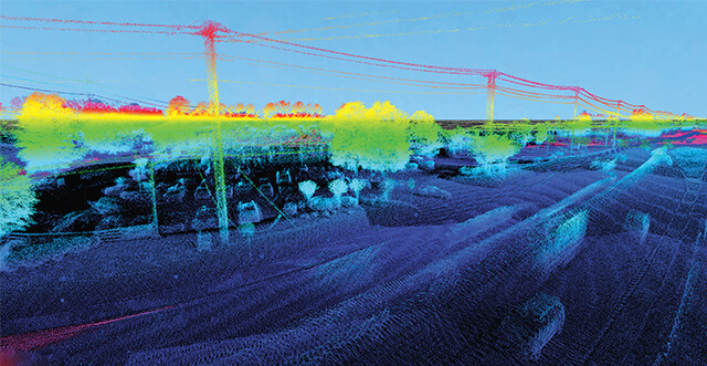
Mobile LiDAR (Light Detection and Ranging) is a powerful remote sensing technology that uses laser pulses to capture detailed 3D data of the environment. Its ability to provide high-precision spatial information in real-time has made it indispensable across a range of industries.
Applications:
- Telecom, Utility, Railways, Smart Cities
- Corridor mapping, asset inspection
- Regulatory compliance, applications
- Pole data collection/pole inspections
- 3D visualizations and inspection
- Vegetation management
- Post-disaster assessment
Let's Know Your Business Better
Phone Number
Fax
+91 40 4994 8682
Email