TRULY3D LiDAR VIEWER
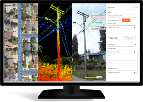
Truly3D LiDAR Viewer is a powerful, web-based platform that enables users to explore three-dimensional point cloud datasets captured by LiDAR sensors. TRuly3D LiDAR viewer delivers three-dimensional laser scanning services for surveying and mapping, terrain modeling, measurements, infrastructure inspection and asset inventory management with specialized tools for Telecom Engineering.
Highlights:
- Unparalleled clarity with precise overlay of high-resolution 72MP panoramic images onto point cloud data
- Callouts, highlights, cylindrical clip features
- Precise measurement marking, and utility tools designed for user convenience
- Custom-designed tools for Pole Loading Analysis
- Export to KML, JSON, and Shapefiles
- Cloud and On-premise solutions
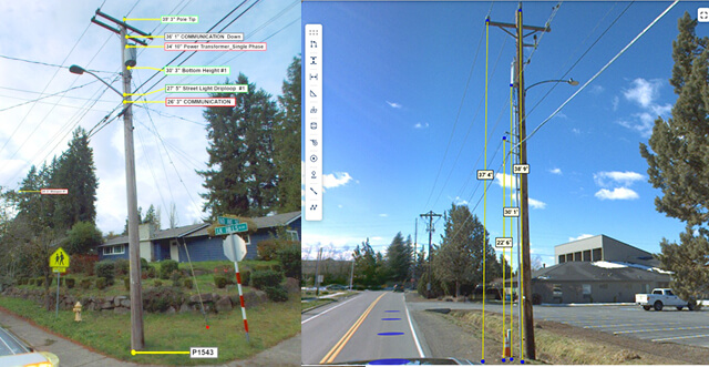
The LiDAR Viewer is an advanced software tool designed to visualize and analyze LiDAR data, enabling professionals to efficiently process and interpret complex 3D datasets. Key applications include:
Applications:
- Corridor survey and mapping
- Field data for regulatory compliances
- Field data for permit application processing
- Pole data collection/Pole inspections
- Asset mapping
- 3D visualizations and walk-through
- Vegetation management
Let's Know Your Business Better
Phone Number
Fax
040-4994 86 82
Email